


The Geographical Data in the Mahābhārata – 2

Geographical data beyond Jaya in the Mahābhārata
When we analyze the geographical data in the whole of Mahābhārata beyond the Jaya portion, we will be able to find out the data distribution in each book (Parva) of Mahābhārata. Each noun found in Mahābhārata is analyzed and it is classified as the name of a place, such as a village, town, city, pilgrim places (tīrthastāna), province, kingdom, region etc.) or as the name of a river, lake, mountain, mountain peak, forest or sea. The spectral analysis of each of these nouns are also done. This will show how many times these noun is repeated in each of the 18 books of the Māhābharata. This entire data is published in the author’s site AncientVoice.
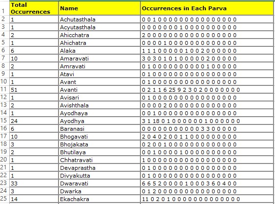
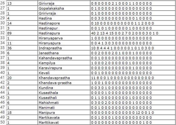
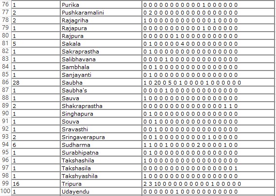
Data on the villages towns and cities mentioned in the Mahābhārata
Around 100 names of Villages, Towns and Cities are analyzed


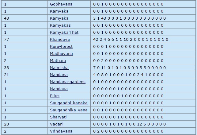
Data on the forests mentioned in the Mahābhārata
Around 30 forests are identified and analyzed.
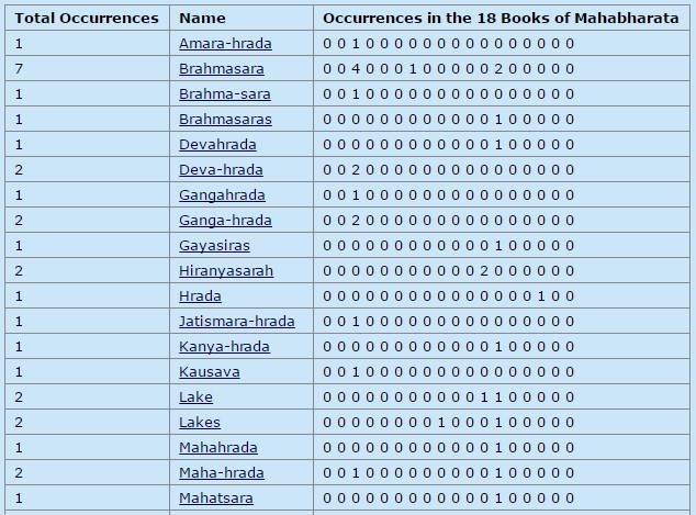
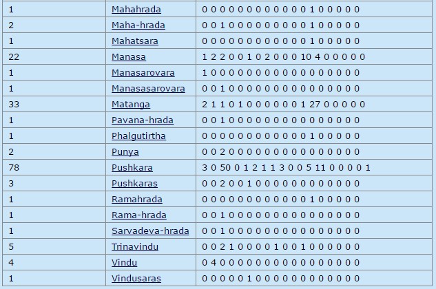
Data on the lakes mentioned in the Mahābhārata
Around 30 lakes are identified and analyzed.
Data on the mountain ranges and peaks in the Mahābhārata
Around 80 mountain ranges and peaks are identified and analyzed. Only a part of it are shown below.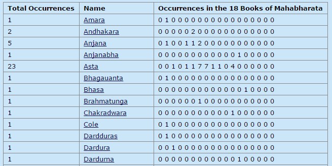
Data on the geographical regions in the Mahābhārata
Around 60 geographical regions are identified and analyzed. Only a part of it are shown below.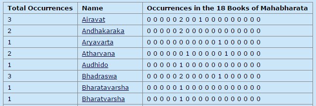
Data on the Tīrthas in the Mahābhārata
Around 300 Tīrthastānās (pilgrim places) are identified and analyzed. Only a part of it are shown below.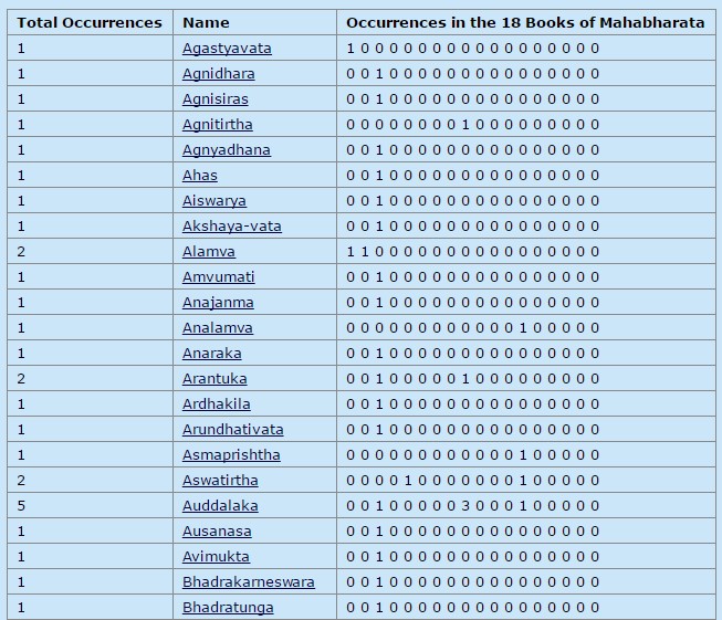
Data on the Kingdoms in the Mahābhārata
Around 80 kingdoms are identified and analyzed. Only a part of it are shown below.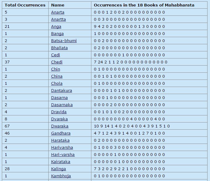
Detailed Maps of Bhāratavarsha
Based on the analysis of these extensive geographical data, detailed maps of Bhāratavarsha are created at province level of details and at village, towns and city level of details. All of these are published in the author’s website AncientVoice and uploaded as reference maps in Wikipedia. The first set of maps is published in 2004 and the second set of maps in 2007.

Figure 12: Bhāratavarsha Kingdom Map
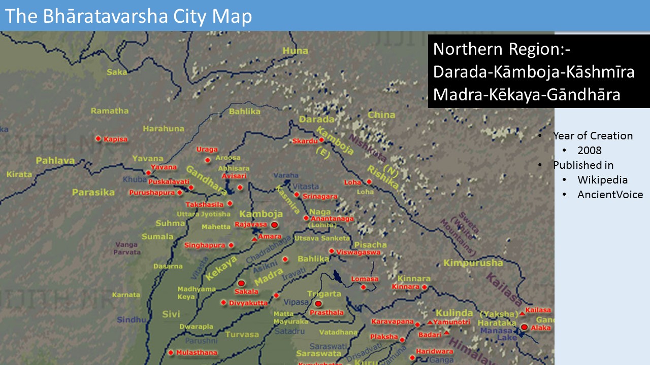
Figure 13: Bhāratavarsha City Map – Northern Region
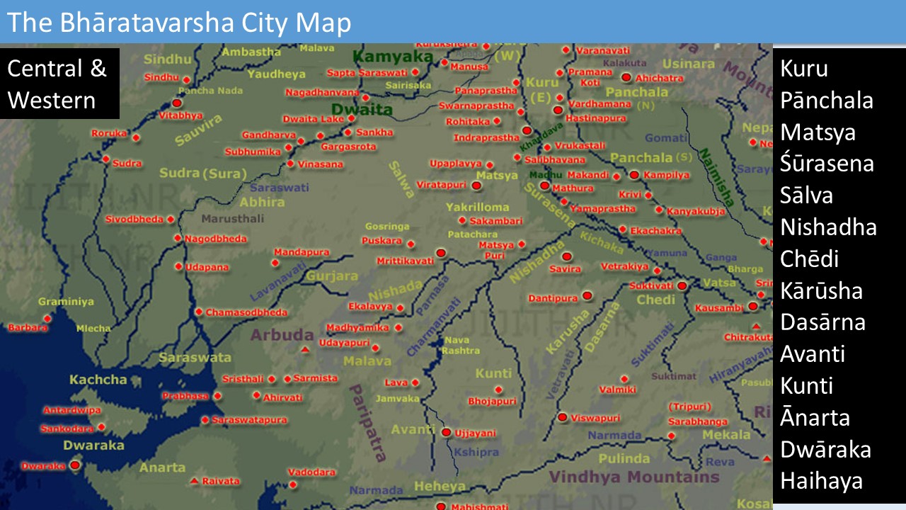
Figure 14: Bhāratavarsha City Map – Central and Western Region
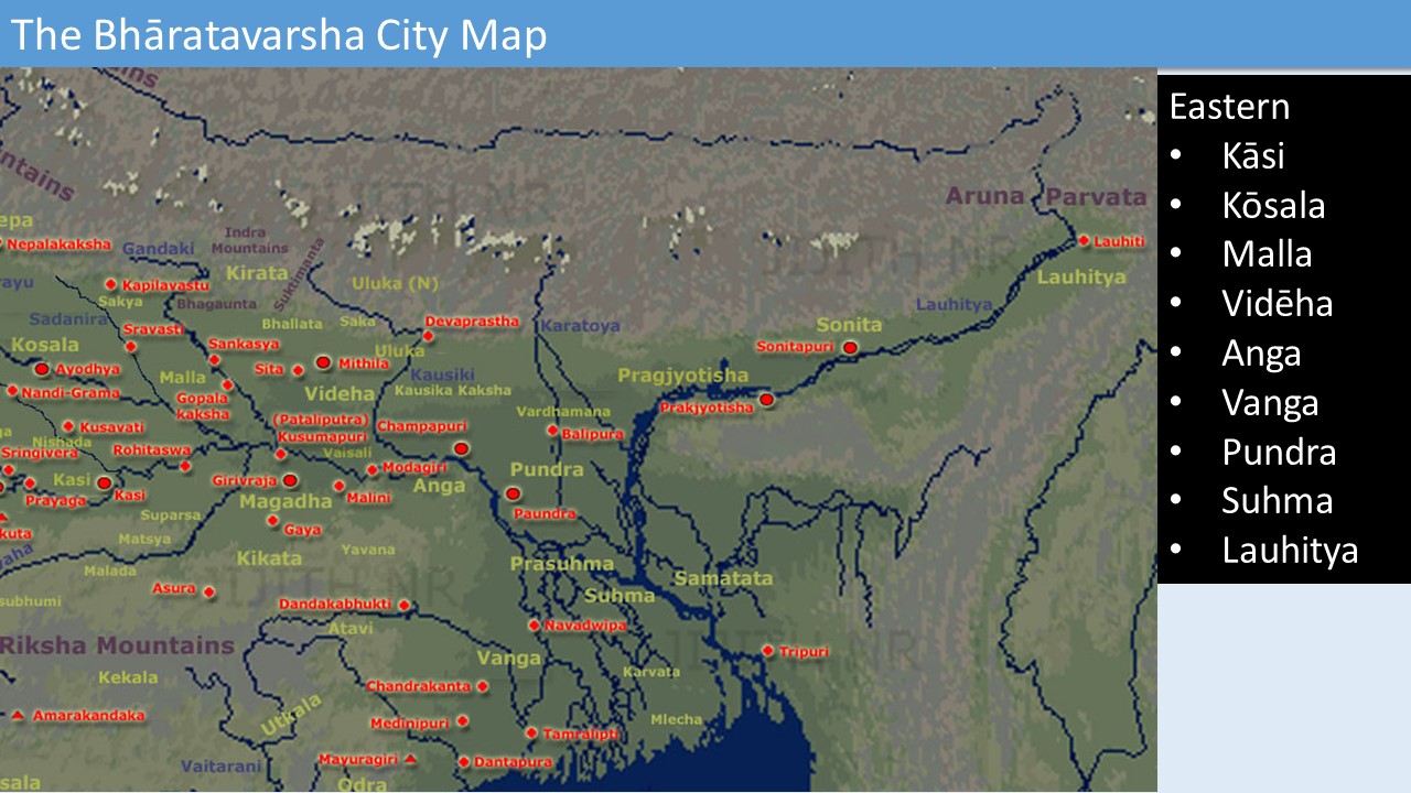
Figure 15: Bhāratavarsha City Map – Eastern Region

Figure 16: Bhāratavarsha City Map – South of Vindhya

Figure 17: Bhāratavarsha City Map – Extreme South
The paper was presented as part of the Mahābhārata Manthan International Conference Delhi – July 19th to 21st, 2017.
Featured Image: Giampaolo Tomassetti